Touristische Informationen für Ihren Urlaub in
-
Name: Villablino
-
8 Orte - Dörfer: 1 Caboalles de Abajo, 2 Caboalles de Arriba, 3 Orallo, 4 San Miguel de Laciana, 5 Villablino, 6 Villager de Laciana, 7 Villar de Santiago, 8 Villaseca de Laciana
-
Oberfläche: 228.1 km
2 = 88 quadratmeilen
-
Bevölkerung: 10860 Bewohner
-
Bevölkerungsdichte: 48 menschen/km
2
-
In der Provinz: León
-
In der autonomen Gemeinschaft: Castile and León
6 Angrenzende - Nachbar gemeinden
Position
x-koordinate (WGS84) GPS: -6.3403
y-koordinate (WGS84) GPS: 42.9701
x-koordinate (UTM30): 227498
y-koordinate (UTM30): 4762953
Tourismus / Reisen
 Burg - Festung:
 Museum:
Unterkunft

Hotel:
booking.com
 Nächste Parador: parador de villafranca del bierzo
 in Villafranca del Bierzo (49 km)
 Camping:
Keine campings

Ferienhaus:
zu verkaufen:
Villablino
Sport und Kulinarisches
 Wein:
Wein:
Keine weinregion
 Golf:
Golf:
Keine golfplätze
Landschaft in der Umgebung:
-
Landschaft:
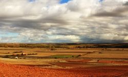
Beautiful landscape
-
Durchschnittliche höhe: 1462 meter
-
Tiefster Punkt: 931 meter
-
Höchster Punkt: 2160 meter
 Eban - Plateau: 8 km2 (4%)
 Hügel: 58 km2 (26%)
 Berge: 161 km2 (71%)
-
En costa: No (abstand: 65 km)
-
Becken (fluss): Duero Northern rivers
-
Fluss:
Naturgebiete (für wandern und Radfahrer)
Topographische Relief (Sehenswürdigkeiten):
Abstand zu Städten
Zu Madrid: 353 km
Zu Barcelona: 722 km
Zu Seville: 622 km
Zu La Coruna: 175 km
Zu Almeria: 758 km
Transport
Straßen:
C-623 (10.9 km), LE-733 (8.2 km), C-631 (6.8 km),
-
Zug-Bahnstrecke:
-
Flughafen: No
-
Wehr: No
Soziale Medien: Facebook und Twitter
 Videos auf youtube von Villablino
 Fotos (Flickr) von der Gemeinde Villablino
 Bilder - Luftaufnahmen von Villablino at panoramio.
Bings maps Villablino
Mapquest Villablino
Loc.Alize.us Villablino
6 Kleinstädte und Dörfer dieser Gemeinde:
1
Llamas de Laciana, 2
Lumajo, 3
Rabanal, 4
Ríoscuro, 5
Robles de Laciana, 6
Sosas de Laciana,


